Drone surveying is a fast way to map large pieces of land from the air. It works well in some situations and falls short in others. Knowing the difference can save you time, money, and a few headaches down the road.
When Drone Surveying Works Well
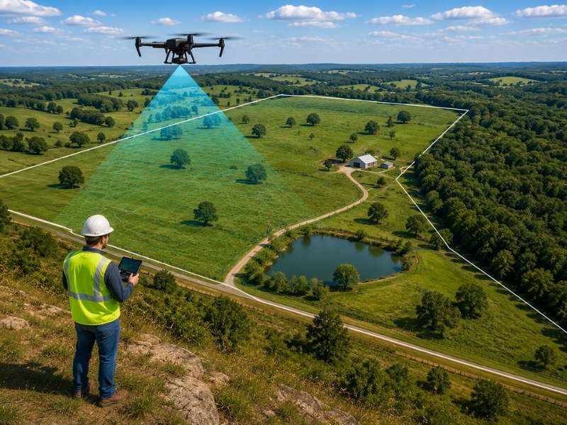
Open land is where drone surveying earns its keep. Fields, pastures, cleared lots, and long stretches of road are all good candidates. A drone can fly over dozens of acres in a fraction of the time it would take a crew to walk the same ground on foot.
Because the camera has a clear view from above, it captures a lot of detail in one pass. This makes drone surveying a strong fit for large properties where walking every inch just isn’t practical. Open ground also means fewer obstacles for the drone’s sensors, so the data tends to come back cleaner and easier to work with later.
When Drone Surveying May Not Work Well
Thick woods and tall brush are the biggest challenge for drone surveying. The camera can only capture what it can see, and dense tree cover blocks the ground almost completely. The same problem shows up in areas with heavy undergrowth or land that’s been left untouched for years.
A drone flying above a forest canopy mostly captures the tops of trees, not what’s happening underneath. So if a property is mostly wooded, or so overgrown that it’s hard to walk through, drone surveying alone probably won’t get the job done. A different method, or a mix of methods, may be needed instead.
How Drone Surveying Helps Rural Landowners
A lot of rural land sits near areas that are growing quickly. New subdivisions might be going up nearby, or a road project could be in the works. Landowners in these spots often want a clear picture of what they’re working with before making any big decisions.
This is where drone surveying can help. It gives owners a bird’s eye view of the land before they start planning. Someone thinking about building a home site, leasing part of the land for farming, or weighing an offer from a developer can get a fast look at the lay of the land without sending a full crew to walk every acre first. It’s not a substitute for careful planning, but it’s a solid first step that helps landowners make more informed choices early on.
What Drone Surveying Can Show
A drone picks up quite a bit from the air. Roads and driveways show up clearly, along with fields, pastures, and any slopes or low spots across the property. Ponds and ditches are easy to spot too, since water tends to stand out against the surrounding land. Fences and tree lines also come through well in the imagery.
Most drones used for this kind of work rely on RTK, or real-time kinematic, GPS technology. This improves location accuracy well beyond what a standard consumer GPS can offer, which matters once the imagery gets turned into a usable map.
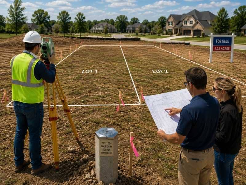
Why Ground Surveying May Still Be Needed
Drone surveying is great for seeing the big picture, but it doesn’t replace a traditional land survey. The two serve very different purposes. A drone shows what’s visible from above. It doesn’t research old deeds, dig through historical records, or set precise legal boundaries.
Property corners and lines aren’t always marked by anything a camera can pick up, and legal boundaries don’t always match what looks obvious on the ground. Anyone who needs to know exactly where a property starts and stops, especially before building, selling, or settling a dispute, still needs a licensed surveyor to confirm those boundaries in person. Drone surveying can support that work, but it can’t stand in for it.
Frequently Asked Questions
What is drone surveying used for on large land?
It collects land details from the air, showing roads, fields, slopes, ponds, ditches, and other features that are visible from above.
Is drone surveying good for wooded land?
Not always. If trees or thick brush block the view of the ground, a drone can’t capture what’s underneath the canopy.
Can drone surveying show property lines?
It can capture visible features like fences and tree lines, but it can’t confirm legal property boundaries. A land survey is still required for that.
When does drone surveying make sense?
It works best on land that’s large, open, or hard to walk on foot. Fields, pastures, and cleared lots are good candidates.
Can drone surveying replace a land survey?
No. A ground survey is still needed to establish property lines, corners, and legal records that a drone can’t determine on its own.