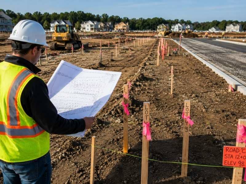
A house survey shows the true condition of a lot before you buy it. It matters even more in places where new buildings happen fast. A lot can look simple on paper but carry hidden changes by the time a deal closes. Buyers who skip a survey in a fast-moving market often find this out the hard way.
How Fast Growth Changes What a “Clean” Lot Actually Looks Like
A lot can look settled and simple when it first goes up for sale. In a fast-growing area, that picture can shift in weeks. A new road plan, a utility expansion, or a zoning change next door can all change what a lot can support. None of these changes show up in a basic listing.
Buyers often assume a lot’s conditions stay the same from listing day to closing day. That assumption breaks down fast when growth nearby is heavy. A house survey checks the lot as it stands right now. It does not rely on how the lot looked when the listing went live.
Why Records Can Lag Behind Growth in a Fast-Moving Market
Public records update on their own schedule. Growth does not wait for that schedule to catch up. When subdivisions and new builds appear fast, the paperwork tracking them often falls behind. A buyer who pulls public records may see information that is already out of date.
This gap creates real risk. A recorded access route may no longer match the path people actually use. A boundary shown in older records may not reflect a recent change. A house survey checks current ground conditions directly instead of trusting records that may not have caught up yet.
What a House Survey Confirms That a Title Report Can’t
A title report and a house survey answer two different questions. The title report shows who owns the property and whether any liens or legal claims sit against it. It does not tell you what the land physically looks like right now.
A house survey fills that gap. It shows current site conditions and physical features as they exist today. In a fast-moving deal, buyers sometimes treat a clean title report as proof that everything is fine. A clean title and a problem-free lot are not the same thing.
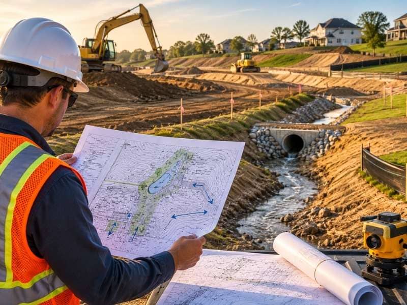
How Nearby Infrastructure Projects Can Quietly Change What You Can Build
Growth brings infrastructure projects with it. Roads get widened. New utility lines get installed. Drainage systems get added or expanded to handle nearby development. Any of these projects can add new setback or access rules to a lot that did not have them before.
These changes often move forward in stages, with notices that are easy to miss. A buyer relying on older records may have no idea a nearby project is already underway. A house survey can flag conditions tied to these projects before they catch a buyer off guard after closing.
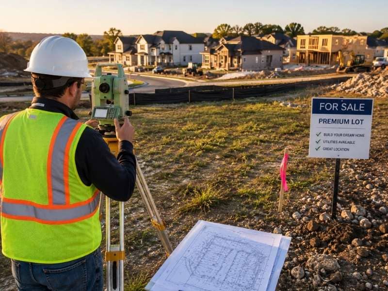
Weighing a Survey’s Cost Against the Risk of Moving Too Fast
A house survey adds a small cost and a short delay to a purchase timeline. In a fast-moving market, that delay can feel like a real obstacle. Buyers under pressure sometimes skip the survey just to keep a deal moving at the pace everyone else expects.
That tradeoff rarely favors the buyer. A survey costs far less than fixing a problem found after closing. Time pressure makes mistakes more likely, not less risky. A short delay for a survey protects a buyer from a much bigger problem later.
Frequently Asked Questions
Why does a fast-growing area increase the chance of an outdated property record?
Fast platting and building activity often move faster than public records can track. This creates a real gap between what is recorded and what is true on the ground. A house survey checks current conditions directly instead of relying on records that may lag behind.
Can a house survey reveal changes tied to infrastructure that hasn’t been built yet?
A house survey captures current site conditions along with any recorded plans tied to the property. This can flag upcoming infrastructure impacts before they show up in a typical listing. Catching this early gives buyers more time to plan ahead.
How is a house survey different from a title search?
A title search reviews ownership history and any legal claims against a property. A house survey physically checks the land and records its current condition. A fast-moving deal benefits from both, since each one answers a different question.
Is a house survey worth ordering when buyers feel pressure to move quickly?
The small cost and short delay of a survey are minor compared to fixing a problem found after closing. Moving fast raises the chance of missing something important. A short pause for a survey protects a buyer from a bigger issue later.
How fast can a house survey typically be completed before a purchase deadline?
Turnaround time depends on the size and shape of the lot, but many residential surveys finish within a short window. Buyers in competitive markets can often request faster service for an added fee. Asking about turnaround time early helps a survey fit into a tight closing schedule.