The Surveyor’s Role When a Lot Is Split, Sold or Reworked
Every change to a lot’s shape runs through one professional. A licensed surveyor stands at the center of any split, sale or boundary rework because the law puts them there. Counties won’t approve new lot lines without a surveyor’s certified work. Title companies won’t insure around unverified descriptions, and buyers can’t trust corners nobody has marked. The deals differ, but the role stays constant. Watch what the surveyor actually does at each stage and you’ll see why lot changes succeed or stall.
The Legal Authority Behind the Signature
State licensing laws reserve boundary work for licensed surveyors. That rule exists for a reason. Deciding where a property line sits is a legal act as much as a measurement. The decision affects the rights of everyone who touches that land afterward. A surveyor’s stamp on a drawing or description means a trained, accountable professional stands behind it.
That accountability makes the rest of the system work. Recorders accept the documents, planning staff rely on the drawings and courts treat the certified work as evidence. When a lot changes shape, every party downstream inherits the surveyor’s conclusions. No other role in the process carries that weight. That’s why no lot change moves forward without one.
Carrying the Application Through Subdivision Review
Subdivision review works like a conversation, and the surveyors speak for the technical side of it. They prepare the drawings the county examines, add the supporting documents the rules require and submit the set for review. Planning staff and the county’s own reviewing surveyor then respond with comments, questions and corrections.
Answering those comments is where experience shows. The surveyor revises the drawings and defends the boundary decisions that need defending. They also resolve conflicts between the reviewer spots between the submission and the county’s records. Each clean response shortens the review. Each vague one adds a cycle, and review cycles are where subdivision timelines quietly die. Surveyors who know a county’s habits go further and shape the first submittal to answer the usual questions before staff asks them. An owner never sees most of this exchange, yet it decides how fast the project clears the county.
Setting the Monuments After Approval
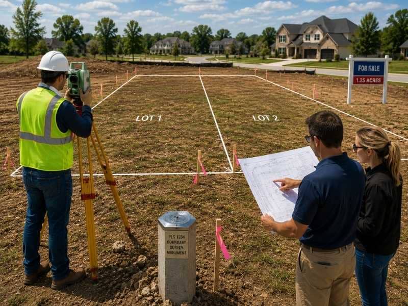
Approval creates lots on paper. The surveyor’s next duty puts them on the ground. After the county signs off, the surveyor sets physical monuments at the new corners. These durable markers sit at the exact spots the approved drawings describe. Each one ties the ground back to the recorded plan. Many counties require this step before the change is complete. Some withhold final recording until the surveyor certifies the monuments exist.
Those markers matter far beyond the current owner. Every future fence builder, contractor and neighboring surveyor will start from them. Corners set carefully today prevent the disputes of the next thirty years. Corners set carelessly create them. Setting monuments looks like the quiet end of the job, but it’s the part the land keeps.
What the Surveyor Verifies When a Changed Lot Sells
A lot fresh from a split or rework carries new paperwork, and new paperwork can hold errors. When one of these lots sells, the surveyor checks that the record and the ground still agree. The deed’s description should match the approved drawings. The recorded documents should reflect the change as the county approved it, and the monuments should sit where the record says they do.
Mismatches surface more often than buyers expect. A deed drafted from an old description, a recording that missed a revision or a monument knocked loose by construction can each cloud the picture. The buyer thinks they know what they own, and the record quietly disagrees. Catching the mismatch before closing turns it into a correction. Catching it after closing turns it into a claim, and claims cost everyone more than the check would have.
Why One Surveyor Should See the Job Through
Lot changes reward continuity. A surveyor who prepared the first application already knows the boundary evidence, the review history and the reason behind every line on the drawings. Handing the later stages to a different firm means the new surveyor rebuilds that knowledge from the file. Files never hold everything.
Continuity also protects the owner during the long tail of the project. Questions surface months after approval, from a title company at closing, a contractor at groundbreaking or a neighbor with a concern. The surveyor of record can answer them from memory and existing fieldwork instead of starting a new investigation. One professional carrying the job from first filing to final monument is the cheapest insurance a lot change can have.
Frequently Asked Questions
What does a surveyor do during subdivision review?
They prepare and submit the drawings the county examines, then answer reviewer comments with revisions and supporting evidence. The back-and-forth between the surveyor and the county largely decides how fast the application clears review.
Does a surveyor have to sign subdivision documents?
Yes. State licensing laws require a licensed surveyor’s stamp and signature on the boundary drawings and descriptions in a subdivision filing. The stamp makes the documents acceptable to recorders, reviewers and title companies.
Who sets the corner markers for new lots?
The licensed surveyor sets them after the county approves the change. Durable markers go in at the exact spots the approved drawings describe. Some counties require certified markers before the new lots can finish recording.
What does a surveyor check when a recently changed lot sells?
They confirm the deed’s description matches the approved drawings and the recorded documents reflect the change correctly. They also check that the monuments still sit where the record places them. Fixing a mismatch before closing beats fighting over it after.
Should the same surveyor handle the whole lot change?
It helps. The original surveyor already holds the boundary evidence, review history and reasoning behind the work, so they can answer later questions from title companies, contractors or neighbors without fresh fieldwork.