
How Survey Mapping Is Keeping Up With Rapid Urban Growth

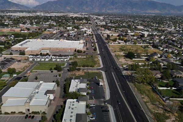
Cities don’t wait. New roads go up. Housing developments spread out. Commercial buildings replace open fields. All of it moves fast. Survey mapping has to move just as fast, and right now, it is.
Survey mapping gives developers an accurate picture of the land before any work begins. It records where boundaries sit, what the terrain looks like, where utilities are buried and what legal limits apply. As growth speeds up, the tools behind survey mapping have gotten faster and more accurate to keep up.
What Survey Mapping Does for Developers
Survey mapping is not just drawing lines on paper. It builds a data-rich record of the land. Developers use that record to plan, get permits and build with confidence.
It Shows What’s Really on the Ground
A site may look flat from the road. A survey map tells the real story. Elevation changes, drainage patterns and existing structures all show up in a proper survey. Developers who skip this step often pay for it with redesigns mid-project.
Survey maps also show what’s underground. Utility lines, drainage systems and buried infrastructure are not visible from the surface. A survey map puts them on record before anyone breaks ground.
It Keeps Projects Legal and Moving
Most local governments require survey maps before issuing permits. Zoning decisions, subdivision approvals and easement agreements all rely on them. A developer without a current, accurate survey map can count on delays.
Why Growth Is Putting More Pressure on Survey Mapping
More projects mean more survey work. That’s simple math. But it’s not just volume that changed. The type of projects has shifted too.
Mixed-use developments and high-density housing require more detail than a basic residential lot. Survey maps for these projects have to capture more data in less time. Construction supply chains move fast. Developers can’t afford to wait weeks for survey results. That pressure pushed survey firms to find ways to work faster without cutting accuracy.
Smaller Parcels, Less Margin for Error
As land costs rise, parcels get smaller. Smaller lots leave less room for mistakes. A boundary error on a single-family lot is one thing. That same error on a ten-unit townhome development is a different problem entirely. Survey mapping has to be exact. Every time.
How Technology Changed the Speed and Accuracy of Survey Mapping
The tools surveyors use today look nothing like what was standard fifteen years ago. Speed and accuracy have both improved, and developers are the ones who benefit most.
Drone Surveys Cover More Ground, Faster
Drones can map large areas in hours. What once took a ground crew several days can now be done with a single flight. The drone captures aerial images. Software converts those images into detailed maps. Developers get results faster and the data holds up.
Drones work well on large parcels, sloped terrain and areas that are hard to reach on foot. For projects in fast-growing areas where land is being developed in stages, drone surveys cut the waiting time significantly.
GPS Equipment Has Changed Field Work
Survey-grade GPS measures positions within centimeters. That level of precision matters when property lines, setbacks and utility corridors all have to line up exactly.
Real-time data collection means surveyors can check and verify readings while still in the field. Errors get caught before the crew leaves the site. That alone has cut down the number of revisions developers used to deal with.
LiDAR Captures What Cameras Miss
LiDAR sends out laser pulses and measures how they bounce back. The result is a dense three-dimensional picture of the land. It captures detail that cameras can’t, including what’s under tree cover or dense vegetation.
For developers working on sites with complex terrain, LiDAR data removes a lot of the guesswork that used to slow projects down.
What Developers Should Do Before a Project Starts
Survey mapping belongs at the start of planning, not the end. Getting it done early means fewer surprises. It also gives the design team accurate data to work from day one.
A site plan built on outdated or estimated data often has to be revised. That costs time and money. Neither is cheap when a project is already in motion.
Ask the survey firm what format the data comes in. Many now deliver files in CAD or GIS formats. That plugs directly into the design workflow and saves the step of converting data between programs.
Licensed surveyors carry legal authority that no satellite image or mapping app can replace. Survey maps produced by licensed professionals are legally binding. They hold up in permit offices, in court and in property disputes.
Frequently Asked Questions
What is survey mapping used for in development projects?
Survey mapping gives developers accurate data about a piece of land. It records boundaries, elevation, utilities and legal limits. Developers use this data to plan buildings, roads and site layouts before construction begins.
How has technology improved the speed of survey mapping?
Drones, survey-grade GPS and LiDAR have all cut down the time it takes to complete a survey map. Large sites that once took days to measure can now be mapped in hours. The data is just as accurate, often more so.
Do I need a survey map before buying land for development?
Yes. A survey map shows exactly what you’re buying. It confirms boundaries, flags encroachments and reveals issues that a title search won’t catch. Skipping it is a risk that tends to show up as expensive problems later.
What’s the difference between a survey map and a plat map?
A plat map is a recorded document showing how land was divided into lots. A survey map is a fresh measurement of the land as it exists today. Plat maps can be outdated. Survey maps reflect current conditions.
Can survey mapping data work directly with CAD and GIS software?
Yes. Most licensed survey firms now deliver data in formats that load directly into CAD and GIS platforms. This saves time and cuts down on errors that happen when data gets manually transferred between teams.