↓
 

Huntsville Land Surveying

Land Surveying in Huntsville, Madison County, Alabama

Huntsville Land Surveying
  • Home
  • ALTA Survey
  • Boundary Surveying
  • Construction Survey
  • Drone LiDAR Mapping
  • Elevation Certificate
  • Lot Survey
  • Land Surveying
  • Topographic Survey | Topo Survey
    • Contour Lines and Finding Profile in a Topographic Map
  • Contact Us
Home - Page 3 << 1 2 3 4 5 6 >>

Post navigation

← Older posts
Newer posts →

How Important is Land Surveying in Today’s World?

Huntsville Land Surveying Posted on August 28, 2012 by HunstvillePLSOctober 29, 2014

“Land Surveying saves money, time, lives, and properties”

Most of you have probably never thought about land surveying until you needed it at some point. Many of us hear about land surveying all the time but never really give it much thought. Since an investment in land and/or a home will likely be the largest investment you will ever make in your lifetime, knowing where your property lines are becomes very important indeed.

The art of land surveying was developed centuries ago. In fact, it’s one of the oldest professions in the world. The fact that it was used by man at such an early time and is still being used now shows how important surveying is to our survival.

Land surveying has many uses:

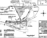
Boundary surveying, for instance, allows you to know where your property corners or property lines are. This is especially helpful when disputes with a neighbour or with other people arise in terms of where your property ends.

Land Surveying Huntsville Land Surveying

Land Surveying Huntsville Land Surveying

If your family wants to divide a tract of land and transfer ownership to other family members, a boundary survey is the first step to do so. If you’re having a building constructed, it is very important that you have the land surveyed to make sure that you are not encroaching onto other peoples’ property. A mistaken building location is very expensive to fix so you might as well invest in a boundary survey to prevent this.

A topographic survey, or topo survey for short, is another important type of land surveying. A topo survey is done to locate natural and man-made features on a particular parcel of land. A topographic survey is different in that the elevation of the land is surveyed which means it can show man-made underground features, retaining walls, utility lines and etc.

Before you start any kind of construction activity, it’s important to have a topo survey done in the area so they’ll have an accurate record of the land’s existing conditions. Yes, that spot with the new mall in the neighbourhood had to have a topo survey done first.

Now, a flood survey or flood determination – this is very important too. It isn’t evident just looking at a property whether you are at risk of flooding or not. And, in some cases, even looking at the flood maps doesn’t give you an accurate answer. The flood survey determines the elevation of the home and compares that to the base flood elevation.

This is the only way to be sure you’re not in a flood hazard zone. If you’ve just been told that you live in a flood-prone area, having that confirmed by a professional land surveyor would let you know how to best proceed.

When getting flood insurance, insurance companies would require an elevation certificate from you. A land surveyor after doing a thorough land surveying of your property would be able to assist you with this.

If a company wants to invest in another state, or if there is a national lender on a commercial project, they will likely need an ALTA Land Title Survey done before anything is constructed. An ALTA Land Title Survey is a lot like a regular boundary survey except that nationally accepted ALTA Standards are used to guide the surveying effort.

Land Surveying Huntsville Land Surveying

Land Surveying Huntsville Land Surveying

Land surveying standards vary widely from state to state and an ALTA Land Title Survey is used to cut down on this variation. Also, an ALTA Land Title Survey typically is more involved than the state standards variety. Because of this, an ALTA survey can be more anywhere from 50% to 200% more expensive than using the state standards only.

If you need this type of survey, I suggest seeking an experienced land surveying company who is familiar with these additional requirements.

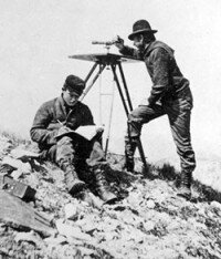
In summary, there are many uses for a land survey and for seeking the services of a land surveyor. If you’re unsure of your situation, consult Huntsville Land Surveying at (256) 585-6002 today or go to the Contact page and send us an email.

Posted in blog, land surveying, land surveyor, Uncategorized | Tagged huntsville land surveyor, importance land surveying, Land Surveying, land surveying huntsville, land surveying huntsville al, land surveying importance, land surveyor, land surveyor huntsville

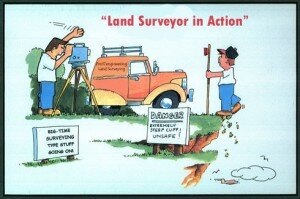
Land Surveying Humor

Huntsville Land Surveying Posted on August 23, 2012 by HunstvillePLSOctober 29, 2014
land surveying humor

land surveying humor


Posted in land surveying, land surveyor | Tagged Huntsville, huntsville land surveying, huntsville land surveyor, Land Surveying, land surveying huntsville, land surveyor, land surveyor humor, land surveyor huntsville

Land Surveyors: Leaving Their Marks

Huntsville Land Surveying Posted on February 20, 2012 by HunstvillePLSMay 22, 2017

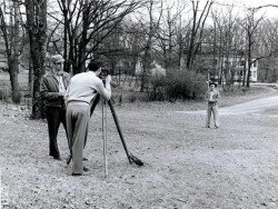
Land surveyors play a very crucial part in people’s everyday life. 

Men and women who combine their sense of adventure, their love of technology, and also their talents in making things happen with their desire to leave a lasting impression are the people who joined the ever expanding realm of land surveying.

Land Surveyors Huntsvill Land Surveyinf

Land Surveyors Huntsvill Land Surveyinf

Land surveying is likely one of the world’s most vital occupations. It’s the only job qualified to form new property boundaries. Moreover, land surveyors also play a significant part in the construction of incredible architectural accomplishments – from the historical achievements that are ages old to the impressive buildings today. As a matter of fact, three of the gents on Mount Rushmore are land surveyors themselves.

Geographic Information System or GIS experts and staff rely upon surveyors for mapping details. The task of your land surveyor has shaped the world as we know it; and it all starts off with small survey markers. It might be merely a small orange survey marker, but this mark is one of the millions that the surveyor uses to take detailed measurements that would become maps which will someday become amazing buildings, new roads, master planned communities, or entire cities – and in each step along the way is a surveyor.

Land surveyors specialize in many positions:

Photogrammetric surveying

In the Office, photogrammetric surveyors deal with cutting-edge software and state of the art machine.

Boundary Surveying

These are land surveyors who do in depth reference research studying maps and boundaries spanning centuries.

Construction Surveying

Within the area, construction surveyors are the power behind any growth; these people team up with engineers to ensure that the structures are constructed within its area and coincide with the type of land where it’s built on.

Hydrographic surveying

Hydrographic surveyors take their work to the lake or sea, determining depths, borders, and a lot more. Geodesy involves surveying where you can acquire specific dimensions for satellite.

Land Surveyors may also find themselves inside the court room. They also perform a vital role in providing expert testimonies with regards to boundaries or even in assisting crime scene cases which involves land.


Qualifications of land surveyors

With merely a high school diploma, anyone can begin as a surveyor, an on the job training that would last for just six weeks, field training, and union apprenticeship. However, a lot of land surveyors are degree holders. Local community universities may offer programs or a two year comprehensive program in land surveying. Incomes tend to be greater than average career fields that need a 4 year college diploma or if these people acquire a degree or higher, they could begin management or one of the many specializations.


Posted in blog, land surveying, land surveyor, Uncategorized | Tagged huntsville land surveying, huntsville land surveyor, Land Surveying, land surveying huntsville, land surveyor, land surveyor huntsville

Post navigation

← Older posts
Newer posts →

Contact Us

    © Copyright Huntsville Land Surveying
    Huntsville, Alabama
    Phone: (256) 585-6002

    Privacy Policy | Terms of Use

    Web Development and SEO by: AuburnBusiness.com

    This website is a marketing website for Mike Stanley, PLS, Stanley Land Surveying, who provides professional land surveying and engineering services in the Huntsville, Alabama area.

    ↑