
Why a Plat of Survey May Not Match Improvements Added Over the Years
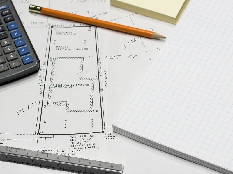
Buy a home in an older neighborhood, and you might notice something that doesn’t add up. The plat of survey on file shows one layout, but the yard in front of you shows another. Maybe there’s a shed the drawing skips over, or a patio sitting where the paper shows plain grass. This kind of gap happens often, and the reason is pretty simple. A survey captures a property on the exact day the surveyor made it. Homes keep changing over the years, but the old drawing never does. Once you understand why, the mismatch starts to make sense. The rest of this post explains how it happens and what you can do about it.
A Plat of Survey Shows the Property at a Specific Point in Time
Think of a plat of survey like a photograph. It shows the land exactly as it looked on a single date. The surveyor walked the property, took measurements, and drew whatever stood there at the time. That date carries a lot of weight, because the drawing basically freezes the property in place. So a survey from twenty years ago shows a twenty-year-old version of the land. Fences, driveways, and buildings all appear the way they were back then. A survey also has a set scope, which means it only shows what the owner asked the surveyor to capture. Anything added after that day never makes it into the picture.
How Years of Property Improvements Can Change What Exists on the Ground
Older homes rarely stay the same for long. Owners tend to add things little by little, one project at a time. One year it might be a new shed in the back, and a few years later someone pours a concrete patio. After that comes a walkway, a retaining wall, or a paved parking spot. Every owner leaves a mark, and over the decades those small changes really stack up. A detached garage might go up, or a deck might stretch off the back of the house. A simple gravel drive might get replaced with poured concrete. None of these show up on a survey the owner ordered before the work happened. Little by little, the property on the ground drifts away from the property on paper.
Why Later Improvements May Not Appear on an Older Survey
A lot of owners get this next part wrong. Adding something to your property does not automatically update your survey. The drawing won’t change on its own, no matter what you build. You could put in a whole new deck, and the old survey would stay exactly the same. A survey is a fixed record from one moment in time, and it doesn’t refresh when you pour concrete or move a fence. Even pulling a building permit won’t circle back and correct an old drawing. So an owner might be holding a survey that looks nothing like the yard outside. Plenty of people don’t even realize the paper is out of date until they go looking for it.
Why the Survey Date Matters When Reviewing an Older Property
The date on a survey can tell you a lot once you know where to look. Start by finding it, since it’s usually printed in the corner of the drawing. Then think back to when the different additions likely went in. A patio poured in 2015 won’t show on a survey from 2005, for example. If the dates don’t line up, you’ve probably found your answer. You can even check old permit records or aerial photos to estimate when a feature first appeared. Comparing those dates helps explain why the yard looks so different from the paper. The wider the gap between the survey and the changes, the less the drawing matches what’s there today.
How a Current Survey Can Document Today’s Property Conditions
A new survey brings the whole record up to date. The surveyor usually starts by pulling any available records for the property. After that, they measure the land in the field and note what actually stands there now. They record the sheds, patios, walls, and paved areas that exist today. The result is a drawing that finally matches what you see with your own eyes. This gives you a clear and current picture of the property. It also comes in handy when you plan an addition, settle a question with a neighbor, or sell the home. With fresh survey information, you’re working from real facts instead of an old snapshot.
Frequently Asked Questions
Can a plat of survey become outdated?
Yes, it can. The boundary lines on the drawing often stay useful for many years. Even so, the physical features on the property can change after the survey date. Later additions like a shed or patio may end up missing from that older drawing.
Why is an improvement on my property missing from the survey?
Someone probably added the feature after the surveyor finished the original work. Surveys don’t update themselves whenever a person builds something new. A patio, structure, walkway, or wall added later simply won’t appear on the old drawing. The only way to capture it is with a fresh survey of the property.
When should a property owner consider getting a new survey?
A new survey makes sense when the property looks very different from an older drawing. It also helps when you need current details for a sale or a planned project. Big changes on the ground are a good reason to check whether your survey still fits. Getting updated information early can save you from surprises down the line.
