
Land Surveying Requirements for Annexation and New Development
huntsvillelandsurveying.com kw: land surveying
Meta Description: Learn how land surveying supports annexation and new development through boundary surveys, legal descriptions, site planning, and approval requirements.
FAQ Description: Find answers about land surveying for annexation, including survey requirements, timelines, topographic surveys, costs, and easement restrictions.
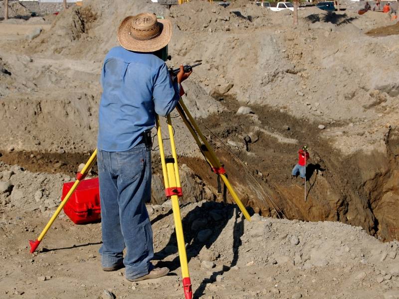
Alt Text: Land surveying for annexation and new development in Huntsville, Alabama, showing property boundaries, terrain, easements, and site planning conditions.
Image File Name: Land Surveying Annexation New Development Huntsville Alabama
Land Surveying Requirements for Annexation and New Development
A parcel can look ready to build on paper and still stall for months at the annexation stage. The usual cause is survey data that’s old, incomplete, or prepared for a different purpose. City staff, engineers, and title companies all rely on the same drawings, so a gap in one place tends to show up everywhere else.
Annexation brings unincorporated land into a city’s limits, which often opens the door to city utilities, zoning, and services. Before that happens, the city needs to know exactly what land it’s taking in and what sits on it. Good land surveying answers both questions early, and it gives developers a firm base for the site plans that follow.
The short version is simple. Order a current boundary survey with a legal description, add a topographic survey if you plan to build, and confirm the city’s submittal rules before any field work starts. The rest of this guide explains why each piece matters and what to ask your surveyor.
Why Land Surveying Is Required for Annexation Projects
Land surveying is required for annexation because the city must define the exact area it’s absorbing. Most annexation petitions need a legal description and a map showing the property’s boundaries and how it touches the current city limits. Many jurisdictions require new territory to be contiguous with existing limits, so the survey has to show that connection clearly.
Survey data also protects the developer. Annexation can change zoning, tax status, and which agency reviews your plans. If the boundary on the petition doesn’t match the deed or the ground, you could annex less land than you own or overlap a neighbor, and fixing that later means another round of filings.
Requirements vary by municipality, county, and project scope. Some cities accept a recent boundary survey, while others want a sealed annexation map drawn to their own standards. Call the planning department before you hire anyone so the survey is built for the right submittal.
Boundary Surveys and Legal Descriptions for Annexation Applications
A boundary survey locates property corners, lines, and monuments, then compares what’s on the ground to the recorded deed and plats. For annexation, it’s usually the first survey a city or attorney will ask for. The surveyor then writes or verifies the legal description that will appear in the petition and any annexation ordinance.
What a Good Legal Description Should Do
A legal description has to close mathematically and match the drawing. Older deeds often rely on vague calls like trees, fences, or a neighbor’s name, and those don’t hold up well in a public filing. Your surveyor can write a metes and bounds description tied to found monuments and a recognized coordinate system when the city requests one.
Annexing Multiple Parcels
Projects that combine several tracts need extra care. Each deed may describe a shared line a little differently, which creates gaps or overlaps between parcels. A surveyor can resolve those conflicts in one drawing and prepare a single perimeter description for the whole annexation area.
Your surveyor will work faster with good records in hand. Pull together what you have before the first site visit. These items help the most:
- Current deeds for every parcel in the project
- Any prior surveys, plats, or title commitments
- The city’s annexation application and map standards
- Names of adjoining owners, if you have them
Topographic Surveys and Site Data for New Development Planning
A topographic survey maps the shape of the land, including elevations, slopes, drainage paths, and visible features. Annexation itself may not require one, but new development almost always does. Civil engineers use topo data to design grading, stormwater systems, roads, and building pads.
Timing matters here. Many developers order the topo alongside the boundary survey so both share the same control points and datum. That saves a second trip to the site and keeps the engineer from reconciling two sets of data.
Data Engineers Usually Ask For
Ask your engineer what contour interval and coverage area they need before field work begins. Flat sites may need a tighter interval because drainage is subtle, while steeper ground can show more with less. Common requests include:
- Spot elevations and contours across the buildable area
- Utility structures such as manholes, valves, and inlets, with rim and invert elevations where accessible
- Edges of pavement, curbs, and driveways
- Tree lines, ditches, and creek banks
- Floodplain boundaries from current FEMA maps when the site is near a mapped flood zone
Flood zone data deserves an early look. If part of the site sits in a special flood hazard area, it can affect where you build, how high finished floors must be, and which permits apply. Your surveyor can plot the mapped zone on the topo so the issue shows up during planning instead of late in design.
How Easements and Existing Property Conditions Affect Development
Easements give someone else the right to use part of your land, often for utilities, drainage, or access. They can limit where buildings, parking, and detention ponds can go. A survey shows recorded easements and visible signs of unrecorded use, so you can plan around them.
Surveyors usually rely on a title commitment to find recorded easements. Without one, some rights of way may be missed. Ask your title company for a commitment early and send it straight to the surveyor.
Conditions That Often Surprise Developers
Some issues only appear once a crew walks the site. Records can be decades out of date, and land use changes quietly over time. Watch for these common findings:
- Fences, sheds, or driveways that cross a property line
- Overhead or buried utility lines with no recorded easement
- Gravel roads or paths that neighbors use for access
- Old drainage ditches that carry water from other properties
- Right-of-way lines that differ from where the road actually sits
None of these automatically ends a project. Each one may need a recorded agreement, a design change, or a conversation with the city before approval. Finding them before the petition is filed gives you room to fix them on your own schedule.
Preparing Survey Documents for Annexation Approval and Construction
The documents you submit for annexation are often the same base data used for permitting and construction. Treating them as one package saves time and money. Ask your surveyor to set up the work so it carries forward from petition to staking.
Common Annexation Submittal Items
Exact requirements depend on the city, but some items show up often. Your planning office will confirm the final list. Typical pieces include:
- A sealed boundary survey or annexation exhibit map
- A legal description of the annexation area
- A vicinity map showing the site relative to current city limits
- Deeds and ownership documents for every parcel
- Digital files in the format the city requests
Carrying Survey Work Into Construction
After annexation, the project usually moves into site plan review, platting, and permitting. The topo supports engineering design, and the boundary supports plats and setback checks. Once plans are approved, construction staking uses the same control to lay out roads, utilities, and buildings in the field.
Confirm survey needs at the start, especially if a closing date, permit deadline, or construction start depends on them. Field crews and review periods both take time. Building that into your schedule early is far easier than rushing it later.
Frequently Asked Questions
Do I need a new survey for annexation if I already have one?
It depends on how old the survey is and what it shows. Many cities want current boundary data and a legal description that matches their submittal format. An older survey can still help your surveyor, but it may not meet the city’s standards on its own. Share the existing survey with your surveyor and the planning office to see whether an update will work.
How long does a survey for annexation take?
Timing varies with parcel size, record complexity, and the surveyor’s workload. A simple single-parcel boundary survey may move quickly, while a multi-parcel project with conflicting deeds can take much longer. Adding a topographic survey extends both field and drafting time. Ask for a realistic timeline before you set a petition or closing dates.
Is a topographic survey required for annexation?
Annexation itself often needs only boundary information and a legal description. Development review is a different story. Most site plans need topographic data for grading and drainage design. Ordering both surveys together is usually the more efficient path if you plan to build.
